Newry

Northern Ireland · County Down · Northern Ireland

Walks from Newry, County Down

📍 Northern Ireland
🌿 Mountain ridges, volcanic ring dyke, canal towpath, drumlin farmland
0 routes available
⛰ Easy to Challenging
Free to access

🥾0 RoutesAvailable
⛰Easy to ChallengingDifficulty
📅April–OctoberBest Months
🚗NewryStart Point

Newry is the southern gateway city of Northern Ireland, sitting where the Mourne and Ring of Gullion landscapes converge. The Mourne Mountains are just twelve miles to the east, Slieve Gullion is twelve miles to the west, and the Newry Canal — Ireland’s oldest summit-level canal — provides easy towpath walking through the city.

A well-connected city with good transport links to Belfast and Dublin, Newry makes a practical base for the remarkable walking landscapes of the Mourne Mountains and Ring of Gullion — both within easy reach for day walks.

All Routes

0 Walks from Newry

Sorted by popularity
Minions
Author Image

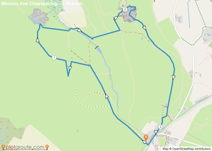
Minions via Cheesewring Quarry and Stowes Hill

Portwrinkle
Author Image

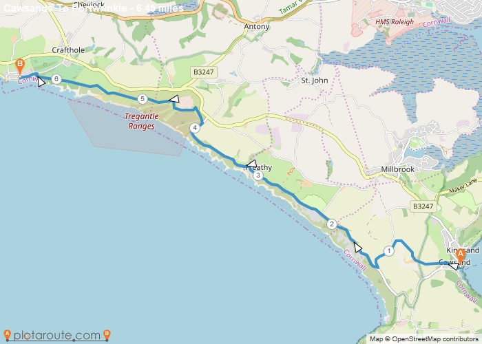
Cawsands To Portwrinkle via South West Coast Path Walk

England
Author Image

Kingley Vale around the Nature Reserve, West Sussex

Author Image

Winchester via St Catherines Hill, Hampshire

Author Image

Winchester via Chilcomb and River Itchen

Fishbourne
Author Image

Fishbourne via Bosham West Sussex – 9.4 Circular Mile Walk

Author Image

Hindhead Devils Punch Bowl – 4.8 Mile Circular Walk

Devon
Author Image

Seaton Devon to Seatown Dorset via South West Coast Path 15 Mile Walk

Devon
Author Image

Sidmouth to Seaton via South West Coast Path

Devon
Author Image

Exmouth to Sidmouth via South West Coast Path

Babbacombe
Author Image

Babbacombe to Exmouth via South West Coast Path

Babbacombe
Author Image

Brixham to Babbacombe via South West Coast Path

Cornwall
Author Image

Portwrinkle to Plymouth via South West Coast Path

Coastal Walks
Author Image

Polperro to Portwrinkle via South West Coast Path

Coastal Walks
Author Image

Par to Polperro via South West Coastal Path

Coastal Walks
Author Image

Marazion to Porthleven via South West Coastal Path

Coastal Walks
Author Image

St Ives to Pendeen via South West Coast Path

Coastal Walks
Author Image

Newquay to Perranporth via South West Coast Path

Coastal Walks
Author Image

Porthcothan to Newquay – South West Coastal Path

Coastal Walks
Author Image

Padstow to Porthcothan via South West Coast Path

At a Glance

Walks available0 routes
DifficultyEasy to Challenging
Best monthsApril–October
TerrainMountain ridges, volcanic ring dyke, canal towpath, drumlin farmland
CountyCounty Down
Dogs welcome✓ Yes

Getting There

📍
Newry, County Down
Open in Google Maps

City centre car parks. Newry station (Dublin–Belfast Enterprise line)

Food & Drink

The Canal Court Hotel, La Di Da restaurant, The Water Gate pub

Notable Walks Nearby

  • Slieve Gullion from Kilnasaggart
  • Ring of Gullion Way
  • Mourne Mountains approach from Rostrevor
  • Newry Canal towpath
  • Camlough Mountain
  • Flagstaff viewpoint
  • All County Down towns →

🗺 OS Map Reference

Walking around Newry is covered by OS OS NI Discovery 29 / 19. Recommended for all routes in this area.

View OS Map Guide

Long Distance Trails Nearby

  • Ring of Gullion Way
  • Mourne Way (approach)

Scroll to Top