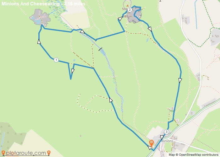
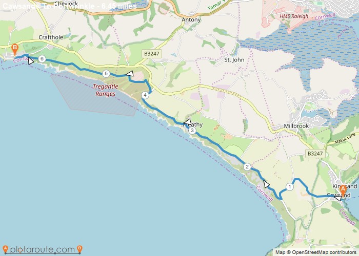
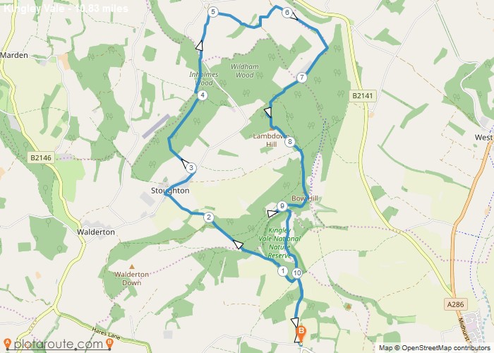
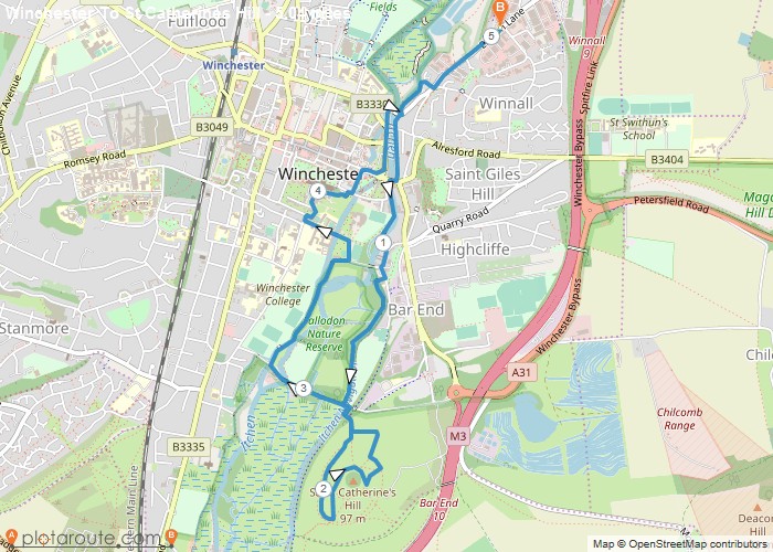
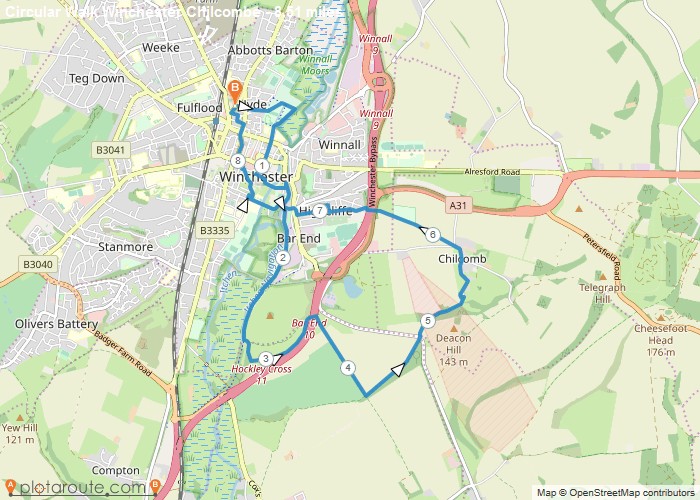
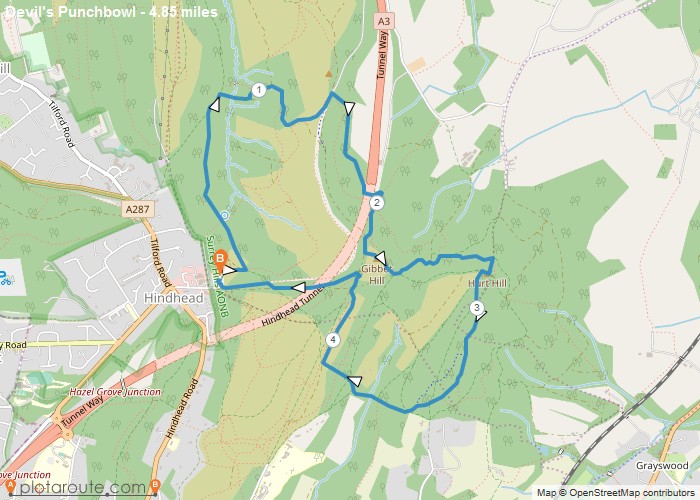
Search for Near Search {"hide_search_input":"","hide_near_input":"","input_size":"","bar_flex_wrap":"","bar_flex_wrap_md":"","bar_flex_wrap_lg":"","input_border":"","input_border_opacity":"","input_rounded_size":"","btn_bg":"","btn_rounded_size":"","btn_rounded_size_md":"","btn_rounded_size_lg":"","bg":"","mt":"","mr":"","mb":"3","ml":"","pt":"","pr":"","pb":"","pl":"","border":"","rounded":"","rounded_size":"","rounded_size_md":"","rounded_size_lg":"","shadow":"","css_class":""} View: Grid 1 View: Grid 2 View: Grid 3 View: Grid 4 View: Grid 5 View: List Minions Favourite Minions via Cheesewring Quarry and Stowes Hill3.2 Miles circular walk from Minions via Cheesewring Quarry and Stowes Hill Walk 18 Cornish Teashop walks OS Maps RequiredDistance: 3.2 milesStarting Point: The Hurlers Car Park, Grasmere Lane, Minions, LinkinhorneEnding Point: The Hurlers Car Park, Grasmere Lane, Minions, LinkinhorneTerrain Type: Off-RoadElevation: 1427 FeetOS Map: OS ExplorerWalking Time: 1 hour 30 minutesInteractive Map: Portwrinkle Favourite Cawsands To Portwrinkle via South West Coast Path Walk6 mile walk from Cawsands to Portwrinkle via South West Coast Path. Distance: 6.4 Miles Time: 3 hours 08 minutesDistance: 6.4 milesStarting Point: KingsandEnding Point: PortwrinkleTerrain Type: Off-RoadElevation: 463 FeetOS Map: OS ExplorerWalking Time: 3 hours 08 minutesInteractive Map: England Favourite Kingley Vale around the Nature Reserve, West Sussex10.8 mile circular walk from West Stoke car park in West Sussex Distance: 10.8 milesTime: 3.5 hoursElevation: 400 footTerrain: footpathsDistance: 10.8 milesStarting Point: Kingley Vale Car Park, West SussexEnding Point: StoughtonTerrain Type: Downland, ancient woodland and open hillsideElevation: 400 FeetOS Map: OS ExplorerWalking Time: 3.5 hoursInteractive Map: NULL Favourite Winchester via St Catherines Hill, Hampshire5 mile circular walk starting from Winchester via St Catherines Hill in Hampshire. Distance: 5 Miles Time: 1.5 hours Elevation:Distance: 5 milesStarting Point: Winchester Car ParkEnding Point: Winchester Car ParkTerrain Type: Riverside meadows and small hilltopElevation: 230 FeetOS Map: OS ExplorerWalking Time: 1.5 hoursInteractive Map: Favourite Winchester via Chilcomb and River Itchen8.5 mile circular walk starting from Winchester via St Catherines Hill and Chilcombe in Hampshire. Distance: 8.5 milesTime: 3 hoursElevation:Distance: 8.5 milesStarting Point: Winchester Car ParkEnding Point: Winchester Car ParkTerrain Type: Downland, river valley and urban pathsElevation: 590 FeetOS Map: OS ExplorerWalking Time: 3 hoursInteractive Map: Fishbourne Favourite Fishbourne via Bosham West Sussex – 9.4 Circular Mile Walk9.4 mile circular walking route from Fishbourne in West Sussex via Bosham, Bosham Hoe and Chichester Harbour. Distance: 9.4 miles Time:Distance: 9.4 milesStarting Point: BoshamEnding Point: BoshamTerrain Type: Coastal foot paths and tracks.Elevation: 206 FeetOS Map: OS ExplorerWalking Time: 4 hoursInteractive Map: Circular Walking Trails Favourite Hindhead Devils Punch Bowl – 4.8 Mile Circular Walk4.8 mile circular walking route from Hindhead in Surrey. Distance: 4.8 milesTime: 1.5 hoursElevation: 879 footTerrain: Coastal foot paths andDistance: 4.85 milesStarting Point: HindheadEnding Point: HindheadTerrain Type: Heathland and woodlandOS Map: OS ExplorerInteractive Map: Devon Favourite Seaton Devon to Seatown Dorset via South West Coast Path 15 Mile WalkSouth West coastal path walking from Seaton in Devon to Seatown in Dorset. Distance: 15.1 miles Time: 6 hours Elevation: 2759Distance: #ref!Starting Point: SeatonOS Map: OS ExplorerInteractive Map: Devon Favourite Sidmouth to Seaton via South West Coast PathSouth West coastal path 10.5 mile route starts from Sidmouth in Devon follows the to Seaton in Devon. Distance: 10.4Distance: #ref!Starting Point: SidmouthEnding Point: SeatonOS Map: OS ExplorerInteractive Map: Devon Favourite Exmouth to Sidmouth via South West Coast PathSouth West coastal path walking from Exmouth in Devon to Sidmouth in Devon. Distance: 12.5 miles Time: 4.5hours Elevation: 1620Distance: #ref!Starting Point: ExmouthEnding Point: SidmouthOS Map: OS ExplorerInteractive Map: 123…784Older posts