Wallingford

England · Oxfordshire · Cotswolds & Oxfordshire

Walks from Wallingford, Oxfordshire

📍 Cotswolds & Oxfordshire
🌿 River valley, chalk downland, ancient earthworks, farmland
0 routes available
⛰ Easy to Moderate
Free to access

🥾0 RoutesAvailable
⛰Easy to ModerateDifficulty
📅Year-roundBest Months
🚗WallingfordStart Point

Wallingford is one of the finest small market towns on the Thames — a Saxon planned settlement with Norman castle earthworks, wide market square and immediate access to Wittenham Clumps, the most recognisable landmark in the upper Thames valley. The Ridgeway is just five miles to the south.

A quiet, characterful Thames-side town with good independent shops, Wallingford is an excellent and underused base for walking the middle Thames and the western Chiltern–Berkshire Downs border.

All Routes

0 Walks from Wallingford

Sorted by popularity
Minions
Author Image

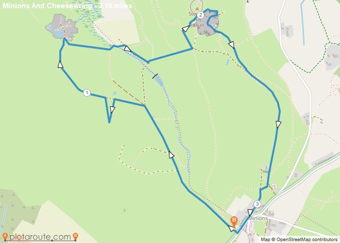
Minions via Cheesewring Quarry and Stowes Hill

Portwrinkle
Author Image

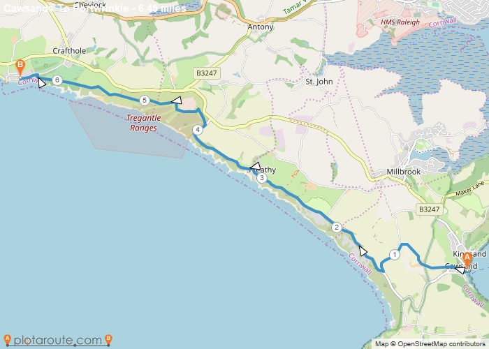
Cawsands To Portwrinkle via South West Coast Path Walk

England
Author Image

Kingley Vale around the Nature Reserve, West Sussex

Author Image

Winchester via St Catherines Hill, Hampshire

Author Image

Winchester via Chilcomb and River Itchen

Fishbourne
Author Image

Fishbourne via Bosham West Sussex – 9.4 Circular Mile Walk

Author Image

Hindhead Devils Punch Bowl – 4.8 Mile Circular Walk

Devon
Author Image

Seaton Devon to Seatown Dorset via South West Coast Path 15 Mile Walk

Devon
Author Image

Sidmouth to Seaton via South West Coast Path

Devon
Author Image

Exmouth to Sidmouth via South West Coast Path

Babbacombe
Author Image

Babbacombe to Exmouth via South West Coast Path

Babbacombe
Author Image

Brixham to Babbacombe via South West Coast Path

Cornwall
Author Image

Portwrinkle to Plymouth via South West Coast Path

Coastal Walks
Author Image

Polperro to Portwrinkle via South West Coast Path

Coastal Walks
Author Image

Par to Polperro via South West Coastal Path

Coastal Walks
Author Image

Marazion to Porthleven via South West Coastal Path

Coastal Walks
Author Image

St Ives to Pendeen via South West Coast Path

Coastal Walks
Author Image

Newquay to Perranporth via South West Coast Path

Coastal Walks
Author Image

Porthcothan to Newquay – South West Coastal Path

Coastal Walks
Author Image

Padstow to Porthcothan via South West Coast Path

At a Glance

Walks available0 routes
DifficultyEasy to Moderate
Best monthsYear-round
TerrainRiver valley, chalk downland, ancient earthworks, farmland
CountyOxfordshire
Dogs welcome✓ Yes

Getting There

📍
Wallingford, Oxfordshire
Open in Google Maps

Town car parks. Cholsey station (1.5 miles) on Didcot–Oxford line

Food & Drink

The Partridge Inn, George Hotel, The Boat Inn Benson

Notable Walks Nearby

  • Wittenham Clumps & Day’s Lock
  • Thames Path to Dorchester
  • Benson & Ewelme circular
  • Ridgeway to Streatley
  • North Moreton
  • Cholsey circular
  • All Oxfordshire towns →

🗺 OS Map Reference

Walking around Wallingford is covered by OS Explorer 170 / 171. Recommended for all routes in this area.

View OS Map Guide

Long Distance Trails Nearby

  • Thames Path
  • Ridgeway

Scroll to Top