Kilkeel

Northern Ireland · County Down · Northern Ireland

Walks from Kilkeel, County Down

📍 Northern Ireland
🌿 Granite mountain ridges, moorland, coastal farmland, fishing harbour
0 routes available
⛰ Moderate to Challenging
Free to access

🥾0 RoutesAvailable
⛰Moderate to ChallengingDifficulty
📅May–SeptemberBest Months
🚗KilkeelStart Point

Kilkeel is the largest fishing port in Northern Ireland, sitting in the flat coastal plain between the Mourne Mountains and the Irish Sea. The southern Mournes rise directly behind the town, offering some of the finest and least-crowded walking in the range, and the Mourne Coastal Route threads east to Annalong and beyond.

A genuine, unpretentious fishing port with excellent fresh fish and direct access to the quieter southern Mournes, Kilkeel makes an excellent and less crowded alternative to Newcastle for those wanting to explore the less-visited southern side of the range.

All Routes

0 Walks from Kilkeel

Sorted by popularity
Minions
Author Image

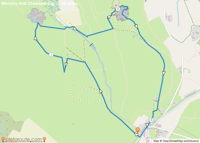
Minions via Cheesewring Quarry and Stowes Hill

Portwrinkle
Author Image

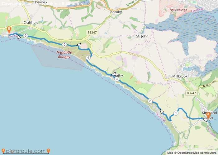
Cawsands To Portwrinkle via South West Coast Path Walk

England
Author Image

Kingley Vale around the Nature Reserve, West Sussex

Author Image

Winchester via St Catherines Hill, Hampshire

Author Image

Winchester via Chilcomb and River Itchen

Fishbourne
Author Image

Fishbourne via Bosham West Sussex – 9.4 Circular Mile Walk

Author Image

Hindhead Devils Punch Bowl – 4.8 Mile Circular Walk

Devon
Author Image

Seaton Devon to Seatown Dorset via South West Coast Path 15 Mile Walk

Devon
Author Image

Sidmouth to Seaton via South West Coast Path

Devon
Author Image

Exmouth to Sidmouth via South West Coast Path

Babbacombe
Author Image

Babbacombe to Exmouth via South West Coast Path

Babbacombe
Author Image

Brixham to Babbacombe via South West Coast Path

Cornwall
Author Image

Portwrinkle to Plymouth via South West Coast Path

Coastal Walks
Author Image

Polperro to Portwrinkle via South West Coast Path

Coastal Walks
Author Image

Par to Polperro via South West Coastal Path

Coastal Walks
Author Image

Marazion to Porthleven via South West Coastal Path

Coastal Walks
Author Image

St Ives to Pendeen via South West Coast Path

Coastal Walks
Author Image

Newquay to Perranporth via South West Coast Path

Coastal Walks
Author Image

Porthcothan to Newquay – South West Coastal Path

Coastal Walks
Author Image

Padstow to Porthcothan via South West Coast Path

At a Glance

Walks available0 routes
DifficultyModerate to Challenging
Best monthsMay–September
TerrainGranite mountain ridges, moorland, coastal farmland, fishing harbour
CountyCounty Down
Dogs welcome✓ Yes

Getting There

📍
Kilkeel, County Down
Open in Google Maps

Town car parks. Bus from Newcastle and Newry (Translink 39)

Food & Drink

The Kilmorey Arms, The Anchor Bar, Rooney’s Fish Restaurant

Notable Walks Nearby

  • Slieve Binnian from Wee Binnian
  • Spelga Dam & Deer’s Meadow
  • Mourne Coastal Route to Annalong
  • Slievemoughanmore
  • Rocky Mountain from Attical
  • Greencastle & Cranfield point
  • All County Down towns →

🗺 OS Map Reference

Walking around Kilkeel is covered by OS OS NI Discovery 29. Recommended for all routes in this area.

View OS Map Guide

Long Distance Trails Nearby

  • Mourne Way
  • Ulster Way

Scroll to Top