Cheddar

England · Somerset · South West England

Walks from Cheddar, Somerset

📍 South West England
Limestone gorge, plateau, woodland, open downland
4 routes available
Easy to Moderate
Free to access

🥾4 RoutesAvailable
⛰Easy to ModerateDifficulty
📅March–NovemberBest Months
🚗CheddarStart Point

Cheddar sits at the foot of the most dramatic limestone gorge in England — a 137-metre-deep canyon cut through the Mendip plateau. Above the gorge, the Mendip plateau opens into wide, windswept walking country with far-reaching views.

A busy tourist village at the gorge entrance, Cheddar is best used as a base for the Mendip plateau. The gorge rim walk is one of the finest short routes in the south-west.

All Routes

4 Walks from Cheddar

Sorted by popularity

New Cheddar
Author Image

Cheddar to Shepton Mallet via Mendip Way

New Cheddar
Author Image

Draycott via Mendip Hills

New Cheddar
Author Image

Cheddar Gorge Cliff Top Walk

New Cheddar
Author Image

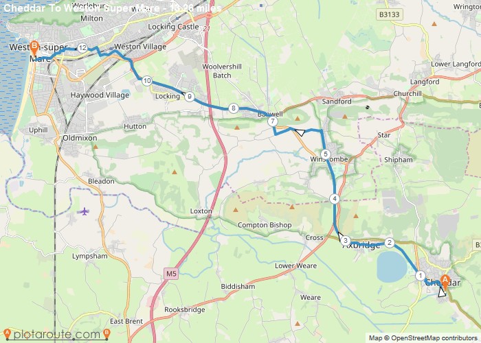
Cheddar To Weston Super Mare

At a Glance

Walks available4 routes
DifficultyEasy to Moderate
Best monthsMarch–November
TerrainLimestone gorge, plateau, woodland, open downland
CountySomerset
Dogs welcome✓ Yes

Getting There

📍
Cheddar, Somerset
Open in Google Maps

Gorge car parks (charge). Village parking available. Bus from Wells and Bristol

Food & Drink

The White Hart, Cheddar Bridge Café, Riverside Inn

Notable Walks Nearby

  • Cheddar Gorge rim walk
  • Crook Peak & Wavering Down
  • Black Rock & Long Wood
  • Axbridge circular
  • Draycott Sleights
  • Ebbor Gorge

🗺 OS Map Reference

Walking around Cheddar is covered by OS Explorer 141. Recommended for all routes in this area.

View OS Map Guide

Long Distance Trails Nearby

  • West Mendip Way

Scroll to Top