Cirencester is the Roman capital of the Cotswolds — Corinium — and the largest town in the AONB, sitting in a wide vale where the upper Churn and Thames gather. The Cotswold Way passes nearby, and the surrounding limestone wold countryside offers excellent, gentle walking.
A handsome, well-served town with an excellent local museum and good restaurants, Cirencester makes a central Cotswolds walking base with easy access to the quieter eastern and southern sections of the AONB.
All Routes
15 Walks from Cirencester
Sorted by popularity
Distance: 7.4 Miles Time: 2 hours 58 minutes Elevation: 830 Feet Terrain: Mixed Start Point: Cirencester End Point: Cirencester null
Distance: 7.4 miles
Starting Point: Cirencester
Terrain Type: Mixed
Elevation: 830 Feet
OS Map: OS Explorer
Walking Time: 2 hours 58 minutes
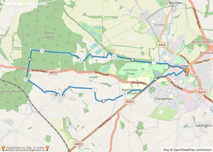
Distance: 9.9 Miles Time: 4 hours 16 minutes Elevation: 85 Feet Terrain: Mixed Start Point: Cirencester End Point: Cirencester null
Distance: 9.9 miles
Starting Point: Cirencester
Terrain Type: Mixed
Elevation: 85 Feet
OS Map: OS Explorer
Walking Time: 4 hours 16 minutes
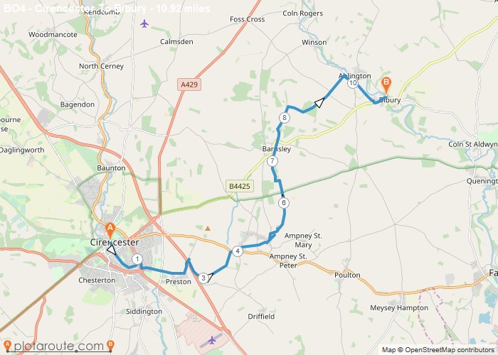
Distance: 10.9 Miles Time: 4 hours 39 minutes Elevation: 1608 Feet Terrain: Mixed Start Point: Cirencester End Point: Cirencester null
Distance: 10.9 miles
Starting Point: Cirencester
Terrain Type: Mixed
Elevation: 1608 Feet
OS Map: OS Explorer
Walking Time: 4 hours 39 minutes
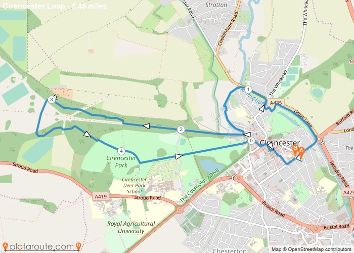
Distance: 5.5 Miles Time: 2 hours 18 minutes Elevation: 1772 Feet Terrain: Mixed Start Point: Cirencester End Point: Cirencester null
Distance: 5.5 miles
Starting Point: Cirencester
Terrain Type: Mixed
Elevation: 1772 Feet
OS Map: OS Explorer
Walking Time: 2 hours 18 minutes
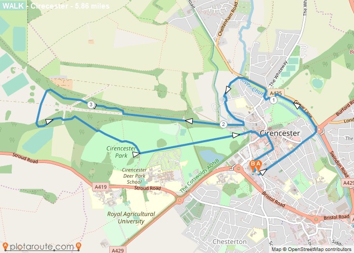
Distance: 5.9 Miles Time: 2 hours 28 minutes Elevation: 486 Feet Terrain: Mixed Start Point: Cirencester End Point: Cirencester null
Distance: 5.9 miles
Starting Point: Cirencester
Terrain Type: Mixed
Elevation: 486 Feet
OS Map: OS Explorer
Walking Time: 2 hours 28 minutes