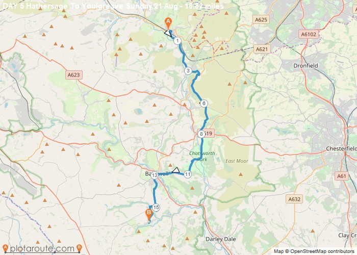
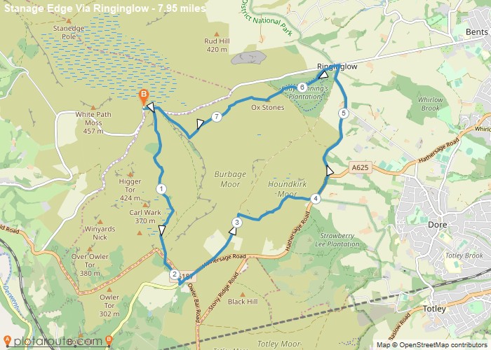
Hathersage is the perfect walking village — a sizeable, well-served settlement in the Hope Valley with direct rail access from Sheffield and immediate access to some of the finest gritstone edge walking in the Peak District. Stanage Edge looms above the village to the west, with Carl Wark hillfort and Higger Tor just beyond.
With a train station, several good pubs and a swimming pool, Hathersage is an excellent base for gritstone edge walking. Stanage Edge is a 30-minute walk from the village, and the Hope Valley line connects directly to Sheffield in 20 minutes.
All Routes
24 Walks from Hathersage
Sorted by popularity
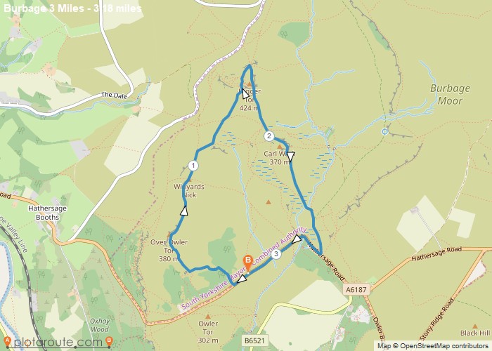
Distance: 3.2 Miles Time: 1 hour 39 minutes Elevation: 315 Feet Terrain: Mixed Start Point: Hathersage End Point: Hathersage 3
Distance: 3.2 miles
Starting Point: Hathersage
Terrain Type: Mixed
Elevation: 315 Feet
OS Map: OS Explorer
Walking Time: 1 hour 39 minutes
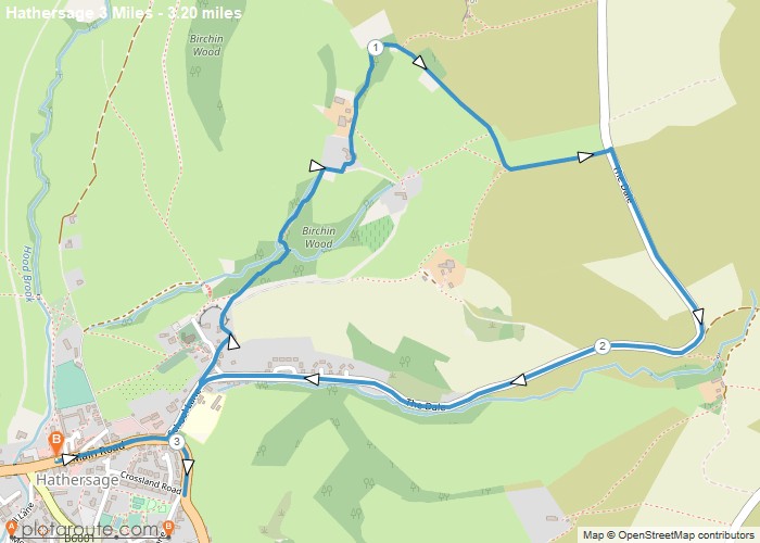
Distance: 3.2 Miles Time: 1 hour 43 minutes Elevation: 105 Feet Terrain: Mixed Start Point: Hathersage End Point: Hathersage Short
Distance: 3.2 miles
Starting Point: Hathersage
Terrain Type: Mixed
Elevation: 105 Feet
OS Map: OS Explorer
Walking Time: 1 hour 43 minutes
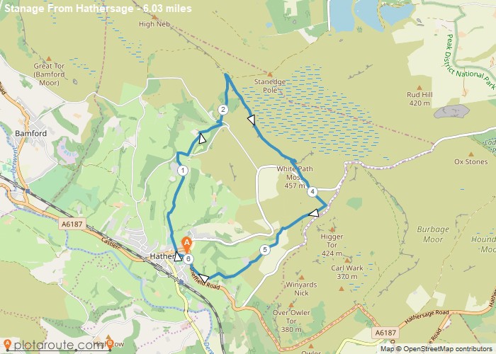
Distance: 6.0 Miles Time: 3 hours 09 minutes Elevation: 1519 Feet Terrain: Off-Road Start Point: Hathersage End Point: Hathersage The
Distance: 6.0 miles
Starting Point: Hathersage
Ending Point: Hathersage
Terrain Type: Off-Road
Elevation: 1519 Feet
OS Map: OS Explorer
Walking Time: 3 hours 09 minutes
Distance: 6.2 Miles Time: 3 hours 14 minutes Elevation: 154 Feet Terrain: Mixed Start Point: Hathersage End Point: Hathersage A hilly circular walking route,
Distance: 6.2 miles
Starting Point: Hathersage
Terrain Type: Mixed
Elevation: 154 Feet
OS Map: OS Explorer
Walking Time: 3 hours 14 minutes
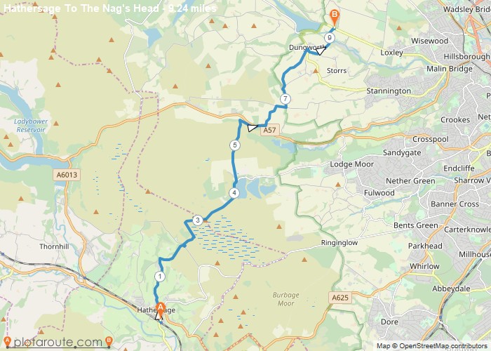
Distance: 9.2 Miles Time: 4 hours 42 minutes Elevation: 1421 Feet Terrain: Mixed Start Point: Hathersage End Point: Hathersage This
Distance: 9.2 miles
Starting Point: Hathersage
Terrain Type: Mixed
Elevation: 1421 Feet
OS Map: OS Explorer
Walking Time: 4 hours 42 minutes
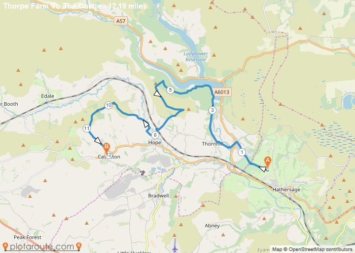
Distance: 12.2 Miles Time: 6 hours 29 minutes Elevation: 138 Feet Terrain: Mixed Start Point: Hathersage End Point: Hathersage A hilly A
Distance: 12.2 miles
Starting Point: Hathersage
Terrain Type: Mixed
Elevation: 138 Feet
OS Map: OS Explorer
Walking Time: 6 hours 29 minutes
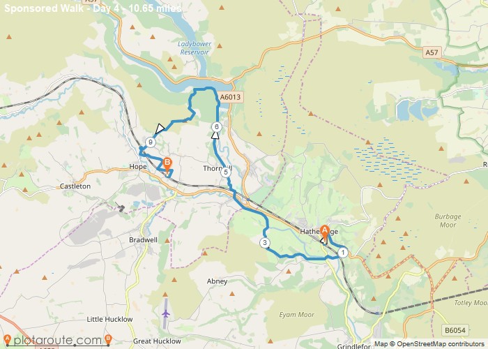
Distance: 10.6 Miles Time: 5 hours 32 minutes Elevation: 1765 Feet Terrain: Mixed Start Point: Hathersage End Point: Hathersage A hilly A
Distance: 10.6 miles
Starting Point: Hathersage
Terrain Type: Mixed
Elevation: 1765 Feet
OS Map: OS Explorer
Walking Time: 5 hours 32 minutes
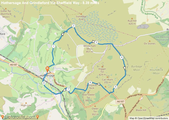
Distance: 8.4 Miles Time: 4 hours 15 minutes Elevation: 23 Feet Terrain: Mixed Start Point: Hathersage End Point: Hathersage A hilly circular walking route,
Distance: 8.4 miles
Starting Point: Hathersage
Ending Point: Hathersage
Terrain Type: Mixed
Elevation: 23 Feet
OS Map: OS Explorer
Walking Time: 4 hours 15 minutes
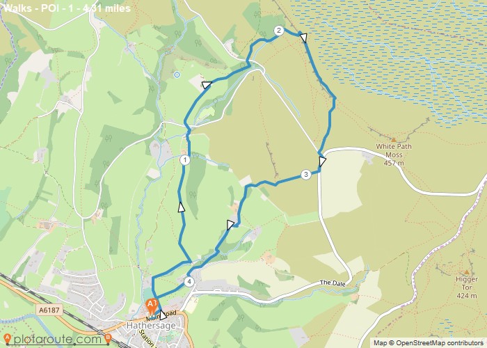
Distance: 4.3 Miles Time: 2 hours 25 minutes Elevation: 3760 Feet Terrain: Off-Road Start Point: Hathersage End Point: Hathersage A hilly circular walking route,
Distance: 4.3 miles
Starting Point: Hathersage
Terrain Type: Off-Road
Elevation: 3760 Feet
OS Map: OS Explorer
Walking Time: 2 hours 25 minutes
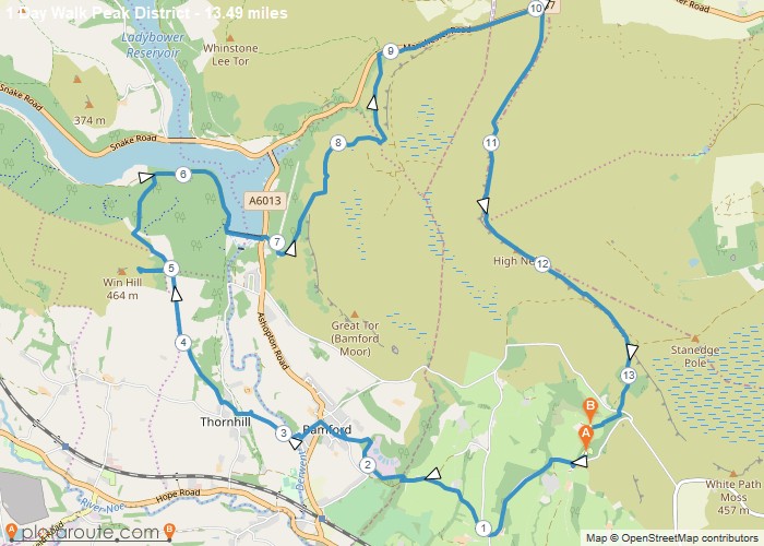
Distance: 13.5 Miles Time: 7 hours 04 minutes Elevation: 3163 Feet Terrain: Mixed Start Point: Hathersage End Point: Hathersage 21km
Distance: 13.5 miles
Starting Point: Hathersage
Ending Point: Hathersage
Terrain Type: Mixed
Elevation: 3163 Feet
OS Map: OS Explorer
Walking Time: 7 hours 04 minutes
Distance: 14.4 Miles Time: 7 hours 06 minutes Elevation: 686 Feet Terrain: Mixed Start Point: Hathersage End Point: Hathersage A hilly circular walking route,
Distance: 14.4 miles
Starting Point: Hathersage
Terrain Type: Mixed
Elevation: 686 Feet
OS Map: OS Explorer
Walking Time: 7 hours 06 minutes
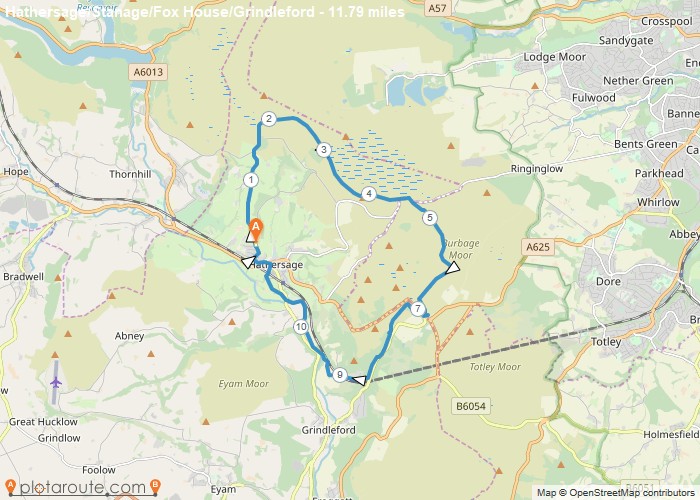
Distance: 11.8 Miles Time: 5 hours 36 minutes Elevation: 75 Feet Terrain: Mixed Start Point: Hathersage End Point: Hathersage Lunch
Distance: 11.8 miles
Starting Point: Hathersage
Ending Point: Hathersage
Terrain Type: Mixed
Elevation: 75 Feet
OS Map: OS Explorer
Walking Time: 5 hours 36 minutes
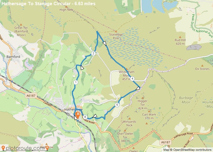
Distance: 6.6 Miles Time: 3 hours 24 minutes Elevation: 732 Feet Terrain: Mixed Start Point: Hathersage End Point: Hathersage A hilly circular walking route,
Distance: 6.6 miles
Starting Point: Hathersage
Terrain Type: Mixed
Elevation: 732 Feet
OS Map: OS Explorer
Walking Time: 3 hours 24 minutes
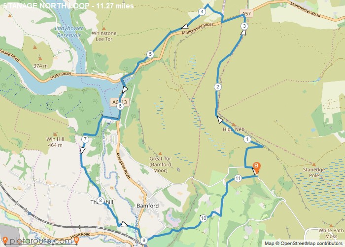
Distance: 11.3 Miles Time: 5 hours 35 minutes Elevation: 154 Feet Terrain: Off-Road Start Point: Hathersage End Point: Hathersage 18
Distance: 11.3 miles
Starting Point: Hathersage
Terrain Type: Off-Road
Elevation: 154 Feet
OS Map: OS Explorer
Walking Time: 5 hours 35 minutes
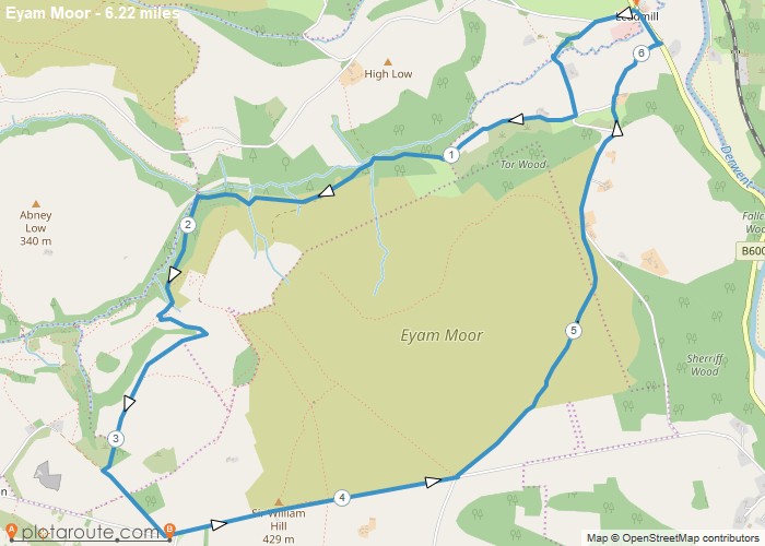
Distance: 6.2 Miles Time: 3 hours 18 minutes Elevation: 220 Feet Terrain: Mixed Start Point: Leadhill End Point: Leadhill A hilly circular walking route,
Distance: 6.2 miles
Starting Point: Leadhill
Ending Point: Leadhill
Terrain Type: Mixed
Elevation: 220 Feet
OS Map: OS Explorer
Walking Time: 3 hours 18 minutes
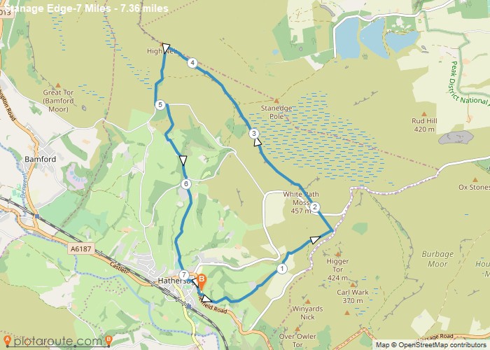
Distance: 7.4 Miles Time: 3 hours 44 minutes Elevation: 52 Feet Terrain: Off-Road Start Point: Hathersage End Point: Hathersage A hilly circular walking route,
Distance: 7.4 miles
Starting Point: Hathersage
Terrain Type: Off-Road
Elevation: 52 Feet
OS Map: OS Explorer
Walking Time: 3 hours 44 minutes
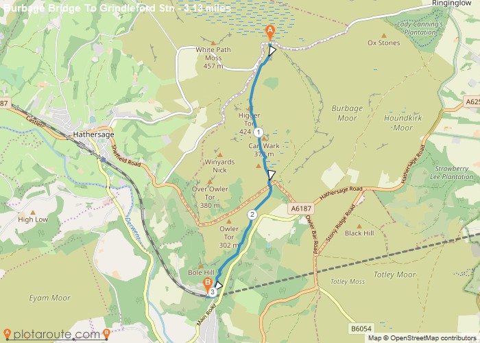
Distance: 3.1 Miles Time: 1 hour 21 minutes Elevation: 79 Feet Terrain: Off-Road Start Point: Hathersage End Point: Hathersage A moderately
Distance: 3.1 miles
Starting Point: Hathersage
Terrain Type: Off-Road
Elevation: 79 Feet
OS Map: OS Explorer
Walking Time: 1 hour 21 minutes
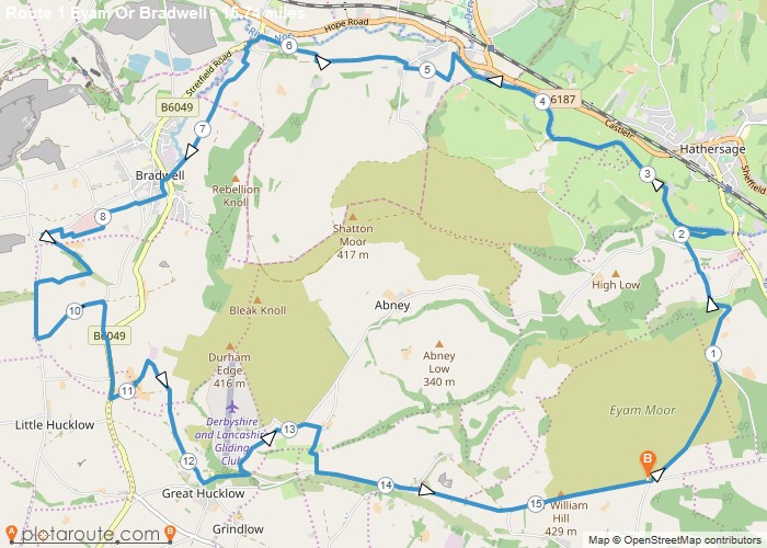
Distance: 15.7 Miles Time: 7 hours 52 minutes Elevation: 784 Feet Terrain: Mixed Start Point: Hathersage End Point: Hathersage Circular
Distance: 15.7 miles
Starting Point: Hathersage
Ending Point: Hathersage
Terrain Type: Mixed
Elevation: 784 Feet
OS Map: OS Explorer
Walking Time: 7 hours 52 minutes
Distance: 16.8 Miles Time: 7 hours 58 minutes Elevation: 1030 Feet Terrain: Mixed Start Point: Hathersage End Point: Hathersage A hilly A
Distance: 16.8 miles
Starting Point: Hathersage
Ending Point: Hathersage
Terrain Type: Mixed
Elevation: 1030 Feet
OS Map: OS Explorer
Walking Time: 7 hours 58 minutes
Distance: 8.0 Miles Time: 3 hours 45 minutes Elevation: 1401 Feet Terrain: Mixed Start Point: Hathersage End Point: Hathersage A hilly circular walking route,
Distance: 8.0 miles
Starting Point: Hathersage
Ending Point: Hathersage
Terrain Type: Mixed
Elevation: 1401 Feet
OS Map: OS Explorer
Walking Time: 3 hours 45 minutes