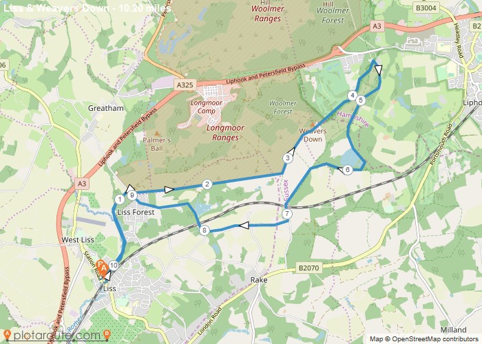
10.2 mile circular walk from Liss Train Station via the edge of Longmore Enclosure, Weavers Down, Folly Pond and The
Distance: 10.2 miles
Starting Point: Liss Train Station
Ending Point: Liss Train Station
Terrain: footpaths and tracks.
Elevation: 210 foot
OS Map: OS Explorer
Walking Time: 3 hours
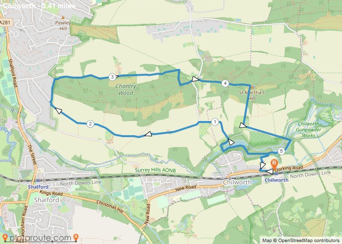
5.4 Mile Circular Walk from Chilworth via Chantry Wood in Surrey Distance: 5.4 milesTime: 2.5 hoursElevation: 210 footTerrain: footpaths and
Starting Point: Chilworth
Ending Point: Chilworth
OS Map: OS Explorer
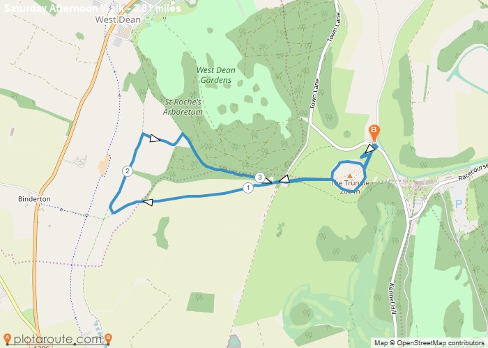
3.8 Mile Circular walking route starting from The Trudle Chichester in West Sussex Distance: 3.8 milesTime: 1.5 hoursElevation: 86 footTerrain:Gravel
OS Map: OS Explorer
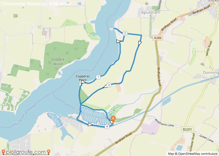
4 mile circular walking route starting from Chichester Marina in West Sussex via Dell Quay. Distance: 4 miles Time: 1.5
Distance: 4 miles
Starting Point: Chichester Marina Car Park
Ending Point: Chichester Marina Car Park
Terrain: Gravel paths, footpaths and pavements.
Elevation: 86 foot
OS Map: OS Explorer
Walking Time: 1.5 hours
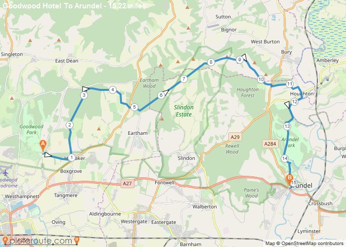
15.2 Mile Walking route from Chichester Goodwood Hotel to Arundel West Sussex. Distance: 15.2 milesTime: 6 hoursElevation: 18 footTerrain: Pavement
Distance: 15.2 miles
Starting Point: Goodwood Hotel
Terrain: Pavement .
Elevation: 18 foot
OS Map: OS Explorer
Walking Time: 6 hours
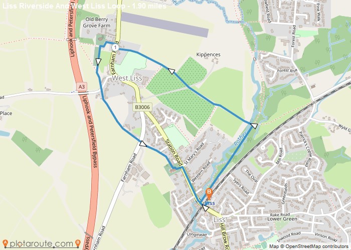
Liss Riverside And West Liss 1.9 Mile Circular Walk. Distance: 1.9 milesTime: 3 hoursElevation: 210 footTerrain: footpaths and tracks.OS Map:Start
OS Map: OS Explorer
Bude
Favourite
18 mile walk from Bude to Crackington Haven following the South West Coastal Path. Distance: 18 milesTime: 9 hoursElevation: 3792
Distance: 18 miles
Starting Point: Bude
Ending Point: Crackington Haven
Terrain: Coastal foot paths and tracks.
Elevation: 3792 foot
OS Map: OS Explorer
Walking Time: 9 hours
Bude
Favourite
25.4 mile walk from Bude in Cornwall to Clovelly in Devon following the South West Coastal Path. Distance: 25.4 milesTime:
Distance: 25.4 miles
Starting Point: Bude
Ending Point: Hartland
Terrain: Coastal foot paths and tracks.
Elevation: 3792 foot
OS Map: OS Explorer
Walking Time: 9 hours
Bude
Favourite
21.5 mile walk following the South West Coastal path from Bude to Tintagel home of King Arthur in Cornwall. Distance:
Distance: 21.5 miles
Starting Point: Bude, Cornwall
Ending Point: Tintagel, Cornwall
Terrain: Coastal foot paths and tracks.
Elevation: 4619 foot
OS Map: OS Explorer
Walking Time: 8 hours
Bude
Favourite
18 mile walk starting from Bude to Hartland following the South West Coastal Path. Distance: 18 milesTime: 9 hoursElevation: 3792
Distance: 18 miles
Starting Point: Bude
Ending Point: Hartland, Cornwall
Terrain: Coastal foot paths and tracks.
Elevation: 3792 foot
OS Map: OS Explorer
Walking Time: 9 hours
