Favourite
7.4 mile walking route starting and finish in Penryn to Falmouth via Mylor, Flushing and the Ferry in Cornwall. Distance:
Distance: 7.4 miles
Starting Point: Penryn Train Station
Ending Point: Penryn Train Station
OS Map: OS Explorer
Walking Time: 2 hours
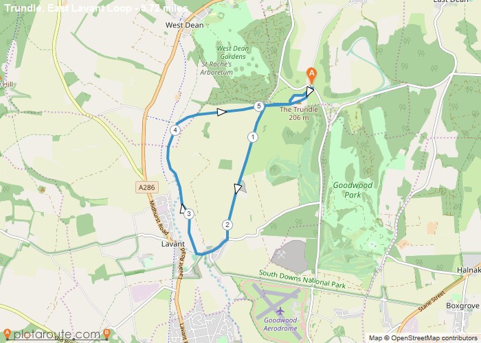
5.7 Mile Circular walking route starting from The Trudle via East Lavant Chichester in West Sussex Distance: 5.7 milesTime: 2
OS Map: OS Explorer
Favourite
3.8 mile walking route starting and finish in Mylor Churchtown in Cornwall. Distance: 3.8 milesTime: 1.5 hoursElevation: 164 footMap: OS Explore
Distance: 3.8 miles
Starting Point: Mylor Churchtown Car Park
Ending Point: Mylor Churchtown Car Park
OS Map: OS Explorer
Walking Time: 1.5 hours
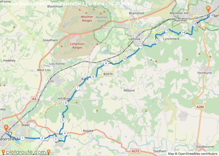
15.3 mile walk from Petersfield in Hampshire to Haslemere in Surrey via the Sussex Border Path Distance: 15.3 milesTime: 3
Distance: 15.3 miles
Starting Point: Petersfield Train Station
Ending Point: Haslemere Train Station
Terrain: footpaths and tracks.
Elevation: 210 foot
OS Map: OS Explorer
Walking Time: 3 hours
Bude
Favourite
7.7 mile walking route from Bude in Cornwall to Morwenstow in Cornwall. Distance: 7.7 milesTime: 3 hoursElevation: 22 footTerrain: Coastal
Distance: 7.7 miles
Starting Point: Bude
Ending Point: Morwenstow
Terrain: Coastal foot paths and tracks.
Elevation: 22 foot
OS Map: OS Explorer
Walking Time: 3 hours
Bude
Favourite
5.6 mile circular walking route from Bude in Cornwall via Salthouse and Bude Canal. Distance: 5.6 milesTime: 2 hoursElevation: 300
Distance: 5.6 miles
Starting Point: Bude
Ending Point: Bude
Terrain: Coastal foot paths and tracks.
Elevation: 300 foot
OS Map: OS Explorer
Walking Time: 2 hours
Favourite
8.1 mile walk starting from Luxulyan train station and finishing at Lostwithiel train station. The route follows the Saints Way
Distance: 8.1 miles
Starting Point: Luxulyan Train Station, Cornwall
Ending Point: Luxulyan Train Station, Cornwall
Terrain: foot paths and tracks.
Elevation: 614 foot
OS Map: OS Explorer
Walking Time: 3 hours
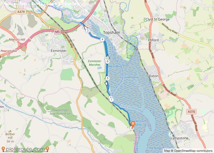
9 mile circular walking route from Powerham via Turf Locks in Devon. Distance: 9 milesTime: 3.5 hoursElevation: 150 footTerrain: footpaths
Distance: 9 miles
Starting Point: Powerham Car Park, Devon
Ending Point: Powerham Car Park, Devon
Terrain: footpaths and tracks.
Elevation: 150 foot
OS Map: OS Explorer
Walking Time: 3.5 hours
Favourite
6.4 mile walking route from Morwenstow via Marsland Wood in Cornwall along the north Cornish coast. Distance: 6.4 milesTime: 2
Distance: 6.4 miles
Starting Point: Morwenstow Village Car Park
Ending Point: Morwenstow Village Car Park
Terrain: Coastal path and tracks.
Elevation: 1,312 foot
OS Map: OS Explorer
Walking Time: 2 hours
Circular Walking Trails
Favourite
4.8 mile circular walking route starting from Lizard village on the Lizard peninsular in Cornwall. Distance: 4.8 milesTime: 1.5 hoursElevation:
Distance: 4.8 miles
Starting Point: Lizard Village Car Park
Ending Point: Lizard Village Car Park
Terrain: Coast footpath and quiet lanes.
Elevation: 597 foot
OS Map: OS Explorer
Walking Time: 1.5 hours


