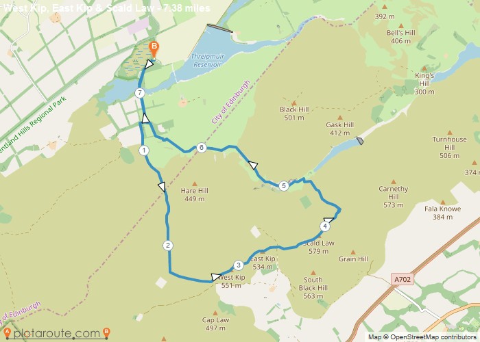
7.3 mile circular walking route starting from . Distance: 7.3 milesTime: 3 hoursElevation: 1594 footTerrain: footpaths and tracks.OS Map:Start Point:
Distance: 7.3 miles
Starting Point: Threipmuir Car Park
Ending Point: Threipmuir Car Park
Terrain: footpaths and tracks,
Elevation: 1594 foot
OS Map: OS Explorer
Walking Time: 3 hours
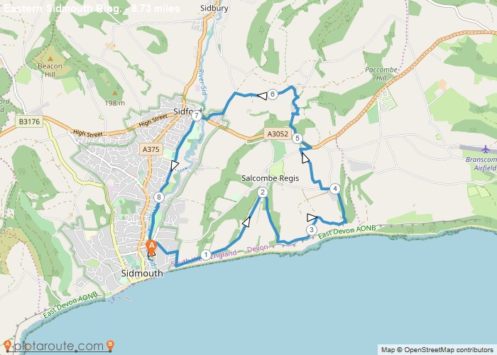
8.7 mile circular walk starting from Sidmouth in Devon via South West Coastal Path, Salcombe Regis and Sidford. Distance: 8.7
Starting Point: Sidmouth
Ending Point: Sidmouth
OS Map: OS Explorer
Circular Walking Trails
Favourite
2.4 mile circular walk starting from National Trust Winkworth Arboretum and following parts of the Blue, Yellow and Red routes.
Starting Point: Busbridge
Ending Point: Busbridge
OS Map: OS Explorer
Circular Walking Trails
Favourite
1 mile circular walk around Winkworth Arboretum in Surrey. The Blue route is access for all abilities. Distance: 1 miles
OS Map: OS Explorer
Circular Walking Trails
Favourite
5.1 mile circular walk starting from Cranleigh via Downs link and River Wey and Arun in Surrey. Distance: 5.1 milesTime:
OS Map: OS Explorer
Favourite
A 6.8 mile circular walking route starting from Kinlochleven in the Highlands. Distance: 6.8 milesTime: 2.5 hoursElevation: 1538 footTerrain: footpaths
Distance: 6.8 miles
Starting Point: Kinlochleven Car Park, Highland.
Ending Point: Kinlochleven Car Park, Highland.
Terrain: footpaths and tracks.
Elevation: 1538 foot
OS Map: OS Explorer
Walking Time: 2.5 hours
Favourite
11.2 mile walking route from Clay Bank to Kildale via Cleveland Way in Yorkshire. This stage of the Cleveland Way
Distance: 11.2 miles
Starting Point: Clay Bank, Yorkshire
Terrain: footpaths and tracks.
Elevation: 1420 foot
OS Map: OS Explorer
Walking Time: 4.5 hours
Favourite
10 mile walking route from Sutton Bank to Osmotherley via Cleveland Way in Yorkshire. This stage of the Cleveland Way
Distance: 10.8 miles
Starting Point: Osmotherley, Yorkshire
Terrain: footpaths and tracks.
Elevation: 2499 foot
OS Map: OS Explorer
Walking Time: 4.5 hours
Favourite
10 mile walking route from Sutton Bank to Osmotherley via Cleveland Way in Yorkshire. This stage takes you along the
Distance: 10.8 miles
Starting Point: Sutton Bank, Yorkshire
Terrain: footpaths and tracks.
Elevation: 2499 foot
OS Map: OS Explorer
Walking Time: 4.5 hours
Favourite
10 mile walking route from Helmsley to Sutton Bank via Cleveland Way in Yorkshire. This stage takes you through some
Distance: 10.1 miles
Starting Point: Helmsley, Yorkshire
Terrain: footpaths and tracks.
Elevation: 1420 foot
OS Map: OS Explorer
Walking Time: 4.5 hours

