Distance: 8.1 Miles
Time: 4 hours 24 minutes
Elevation: 135 Feet
Terrain: Mixed
Start Point: Edale
End Point: Edale
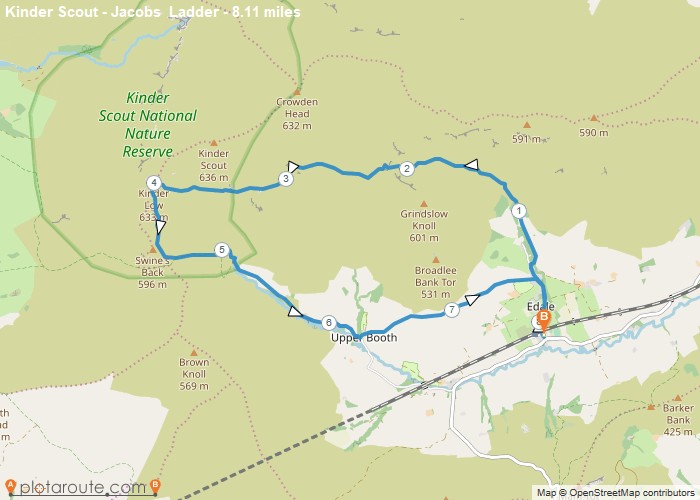
From the main car park, turn right heading north along Marys Lane, passing the Old Nags Head pub.After about half a mile from the car park, turn right following the fingerpost signed Grindsbrook.Cross the bridge and head left onto the well-defined slabbed path.Continue along the path for about 1.5 miles, ascending up Grindsbrook. Note that the well-defined path becomes less so and much rockier. Some scrambling may be necessary.Once at the top on Edale Moor, signified by a large cairn, take the slabbed path continuing forward onto the moorland.Shortly you will be looking down onto Crowden Clough, from where the path will skirt around the edge for about half a mile until meeting a stream. Cross the stream and take the higher path on the right, ascending up towards Crowden Tower.Continue on the path for about 1 mile, cutting through some stunning rock formations.Upon reaching Noe Head, continue on the path left heading southwest towards Jacobs Ladder.Head down Jacobs Ladder and follow the track towards Upper Booth Farm for about 1 mile.At Upper Booth, turn left and head through the courtyard of buildings and head for the gate with the fingerpost signed to Edale.The path once again ascends and eventually descends back towards Edale, bringing you out at the Old Nags Head pub.After refreshments, head south back along Marys Lane, retracing your steps back to the car park.
OS Maps Required
OS Explorer Map (102, 103, 104, 105, 106, 107, 109 and 111) Cornwall Set
Map of Trail

Sorry, no records were found. Please adjust your search criteria and try again.
Sorry, unable to load the Maps API.

