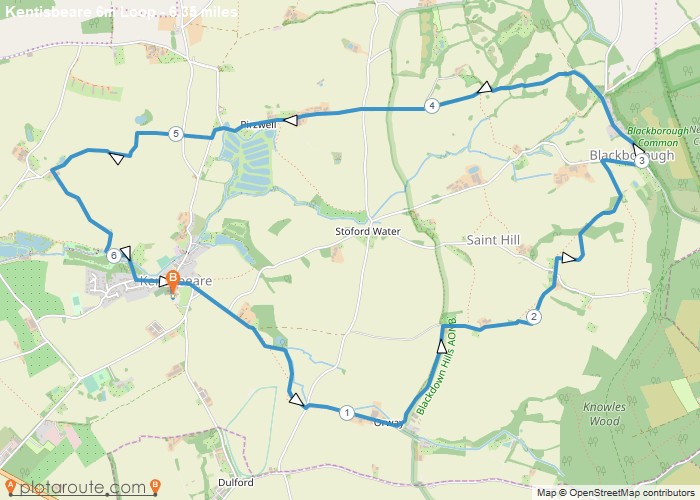
Distance: 6.3 Miles
Time: 3 hours 03 minutes
Elevation: 194 Feet
Terrain: Mixed
Start Point: Kentisbeare
End Point: Kentisbeare
DirectionsThese directions are not to be used without a map:A From the car park walk towards the church and take a footpath to the right of the building. At the T junction turn right onto Priest Hill.After 130 where the road bends to the right take the left fork and continue along the lane until you see a track on right. Turn into the track and after a short while take footpath on right. Follow this path for 0.4 milesTurn left onto a lane then take lane on right.B Continue on this lane for 0.35 miles then after the farm yard turn left onto a Footpath.Follow this Footpath and after 0.41 miles turn right onto a service road. Continue in easterly direction.The drive turns into a track then into a path.Take this footpath which eventually leads to Saint Hill. Where the track joins the lane continue left then soon take a footpath on right past the chapel.C Follow this path ( a steady climb) until you reach a lane – just before the lane the path runs parallel to a private drive.Turn right,still climbing,and turn left at the next junction,after a telephone booth.D .Continue along this lane through Blackborough (no pub) and past the cemetery on right.Just before a gate where the lane becomes a drive,turn left onto public footpath.Descend until you reach the beginning of a lane near some houses. During the winter this can be muddy.E After 0.2 miles you arrive at a junction. Cross over and follow the lane past Pirzwell farm.Ignoring a lane junction on right the road bends sharp left and soon you will see a track on right.F Follow this track (Green Lane) .After 0.69 miles turn left onto a lane called Silver Street .Follow this lane back into Kentisbeare.
OS Maps Required
OS Explorer Map (102, 103, 104, 105, 106, 107, 109 and 111) Cornwall Set
Map of Trail

Sorry, no records were found. Please adjust your search criteria and try again.
Sorry, unable to load the Maps API.

