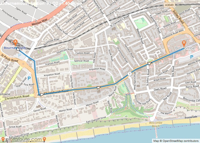
Distance: 1.4 Miles
Time: 35 minutes
Elevation: 1621 Feet
Terrain: Road
Start Point: Bournemouth
End Point: Bournemouth
Once on the A35 if you don’t want to walk any bus will take you to Boscombe bus station. Don’t cross the A35 otherwise the buses will be going the wrong way.Places nearby to eat:Boscanova – great but usually shuts at 6pmBournemouth Pizza company – St Swithuns Road which is near the train station.McDonalds – closest to the O2Urban beach – sister to urban reefUrban reef – on the sea frontReef encounter – diner type place on sea roadDon’t eat at the Jerk chicken hut
OS Maps Required
OS Explorer Map (102, 103, 104, 105, 106, 107, 109 and 111) Cornwall Set
Map of Trail

Loading...
No Records Found
Sorry, no records were found. Please adjust your search criteria and try again.
Maps failed to load
Sorry, unable to load the Maps API.

