Distance: 3.2 Miles
Time: 1 hour 29 minutes
Elevation: 879 Feet
Terrain: Mixed
Start Point: Westward Ho!
End Point: Westward Ho!
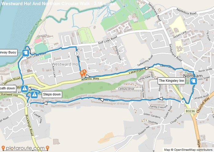
This walk links Westward Ho! and Northam, mainly along pavements, with the option to stop off for a drink at either the Fairway Buoy Pub on Westward Ho! sea front or the Kingsley Inn in Northam. Start and end point is at the top of Beach Road in Westward Ho! but you could join this circular route from anywhere along it. Along the way you’ll pass the rather grand houses on Bay View Road and the walk can easily be done in a morning or afternoon. NB. There’s a set of STEPS and also a STEEP SLOPE that may not suit everyone. These are shown on the route map.
OS Maps Required
OS Explorer Map (102, 103, 104, 105, 106, 107, 109 and 111) Cornwall Set
Map of Trail