Distance: 29.2 Miles
Time: 14 hours 50 minutes
Elevation: 860 Feet
Terrain: Mixed
Start Point: Weston-super-Mare
End Point: Weston-super-Mare
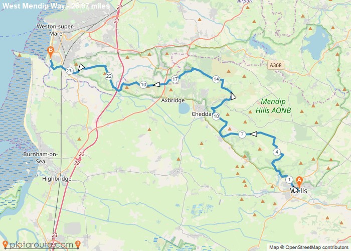
30 mile route from Wells Cathedral to the Bristol Channel at Uphill crossing the Mendip Hills and Mendip AONB.
OS Maps Required
OS Explorer Map (102, 103, 104, 105, 106, 107, 109 and 111) Cornwall Set
Map of Trail