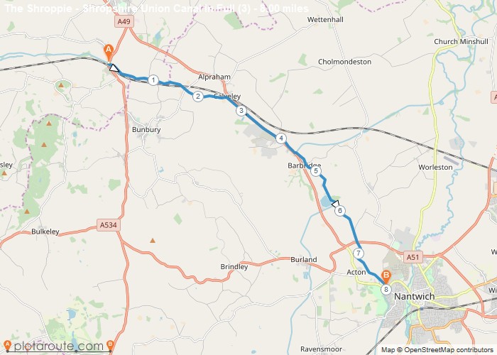
Distance: 8.0 Miles
Time: 3 hours 18 minutes
Elevation: 1375 Feet
Terrain: Off-Road
Start Point: Tiverton
End Point: Tiverton
From where the second installment left off outside the village of Tiverton through to Natwich
OS Maps Required
OS Explorer Map (102, 103, 104, 105, 106, 107, 109 and 111) Cornwall Set
Map of Trail