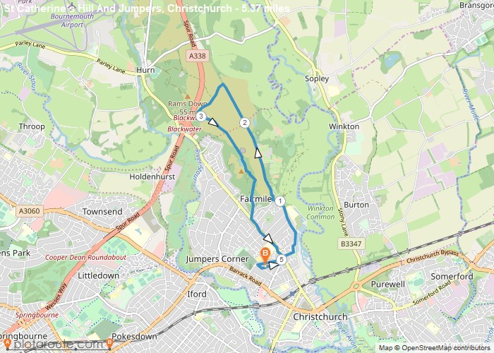
Distance: 5.4 Miles
Time: 2 hours 17 minutes
Elevation: 1086 Feet
Terrain: Mixed
Start Point: Fairmile
End Point: Fairmile
The start and end point can easily be varied due to the free on-street parking. This one starts at BH23 2DF.The route takes in a bit of street walking, off road along the old railway line and off road over St Catherine’s Hill.Mainly paths and gravel.The section along Dudmoor Lane (the old railway line) states no public right of way, but there is never an issue for walkers to take this route.
OS Maps Required
OS Explorer Map (102, 103, 104, 105, 106, 107, 109 and 111) Cornwall Set
Map of Trail