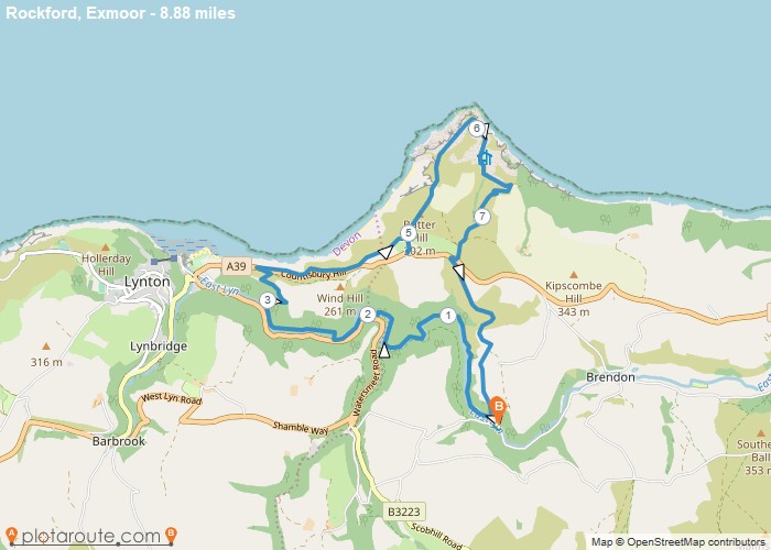
Distance: 8.9 Miles
Time: 5 hours 13 minutes
Elevation: 1240 Feet
Terrain: Off-Road
Start Point: Brendon
End Point: Brendon
Rockford / Coleridge Way / The Tors / Ninney Well / Blue Ball Inn, Countisbury / Foreland Point / Barna Barrow / Church Path / Wilsham / Rockford
OS Maps Required
OS Explorer Map (102, 103, 104, 105, 106, 107, 109 and 111) Cornwall Set
Map of Trail