Distance: 7.8 Miles
Time: 3 hours 41 minutes
Elevation: 843 Feet
Terrain: Mixed
Start Point: Stanningley
End Point: Stanningley
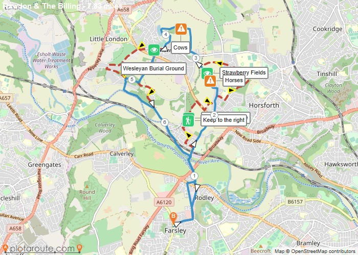
This 8 mile walk transports you through a selection quiet fields on your gradual journey to the peak of The Billing. The route passes a fine selection of residences historic, modern, distinguished and rural. At the summit, views reach out in all directions; covering the River Aire catchment, Airport, across the City of Leeds and well beyond.Returning takes a steeper descent through history as is abundant around West Leeds. The lower area of Rawdon offers glimpses of fine historic dwellings. Originally constructed by affluent figures who chose to travel by train when the railway line was first constructed.The conclusion of the descent opens to the attractive riverside. Tracing the Aire down to the 250 year old Calverley Bridge before our return climb to Farsley.runningseeds.co.uk | @RunningSeeds
OS Maps Required
OS Explorer Map (102, 103, 104, 105, 106, 107, 109 and 111) Cornwall Set
Map of Trail