Distance: 8.3 Miles
Time: 3 hours 51 minutes
Elevation: 846 Feet
Terrain: Mixed
Start Point: Stanningley
End Point: Stanningley
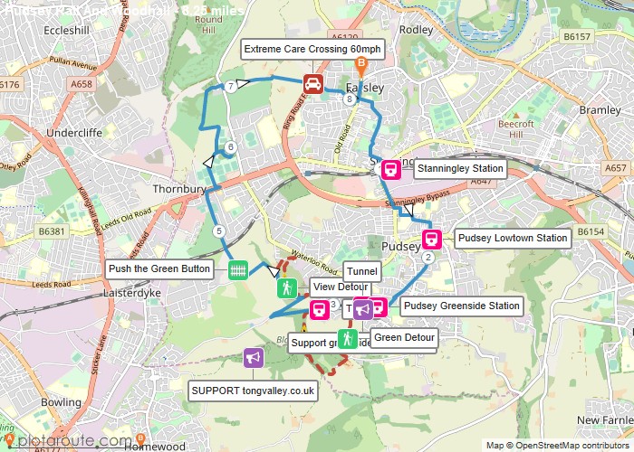
Following the route of the old Pudsey branch line then over to Woodhall Lake and Hill.Please support:https://www.tongvalley.co.uk/ – save Tong Valley from houses and a huge new road.https://greensidegreenway.org/ – save the tunnel from infill and create a green way.
OS Maps Required
OS Explorer Map (102, 103, 104, 105, 106, 107, 109 and 111) Cornwall Set
Map of Trail