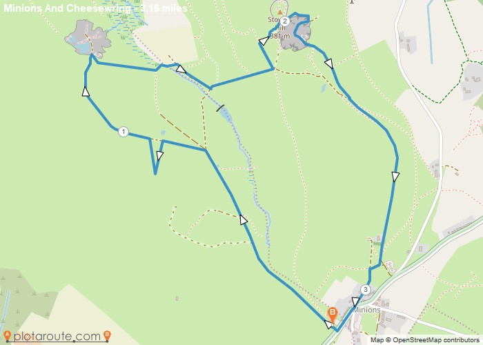
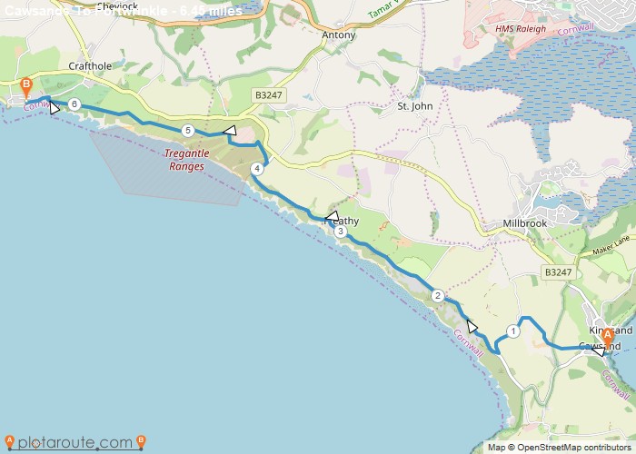
All Alfrick Place Categories Loading... No Records Found Sorry, no records were found. Please adjust your search criteria and try again. Maps failed to load Sorry, unable to load the Maps API. Loading categories... Search for Near Search {"hide_search_input":false,"hide_near_input":false,"input_size":"","bar_flex_wrap":"","bar_flex_wrap_md":"","bar_flex_wrap_lg":"","input_border":"","input_border_opacity":"","input_rounded_size":"","btn_bg":"","btn_rounded_size":"","btn_rounded_size_md":"","btn_rounded_size_lg":"","bg":"","mt":"","mr":"","mb":"3","ml":"","pt":"","pr":"","pb":"","pl":"","border":"","rounded":"","rounded_size":"","rounded_size_md":"","rounded_size_lg":"","shadow":"","css_class":""} Frisby on the Wreake Favourite Frisby on the Wreake via Wreake ValleyDistance: 3.9 Miles Time: 1 hour 38 minutes Elevation: 92 Feet Terrain: Mixed Start Point: Frisby on the Wreake EndDistance: 3.9 milesStarting Point: Frisby on the WreakeEnding Point: Frisby on the WreakeTerrain Type: MixedElevation: 92 FeetOS Map: OS ExplorerWalking Time: 1 hour 38 minutesInteractive Map: Devon Favourite Knettishall Heath – East Wretham Peddars WAYDistance: 6.5 Miles Time: 2 hours 45 minutes Elevation: 2139 Feet Terrain: Mixed Start Point: Rushford End Point: Rushford nullDistance: 6.5 milesStarting Point: RushfordTerrain Type: MixedElevation: 2139 FeetOS Map: OS ExplorerWalking Time: 2 hours 45 minutesInteractive Map: Cumbria Favourite Wainwright – Coniston Fells #19Distance: 18.9 Miles Time: 11 hours 48 minutes Elevation: 2444 Feet Terrain: Off-Road Start Point: Lowick Green End Point: LowickDistance: 18.9 milesStarting Point: Lowick GreenTerrain Type: Off-RoadElevation: 2444 FeetOS Map: OS ExplorerWalking Time: 11 hours 48 minutesInteractive Map: Minions Favourite Minions via Cheesewring Quarry and Stowes Hill3.2 Miles circular walk from Minions via Cheesewring Quarry and Stowes Hill Walk 18 Cornish Teashop walks OS Maps RequiredDistance: 3.2 milesStarting Point: The Hurlers Car Park, Grasmere Lane, Minions, LinkinhorneEnding Point: The Hurlers Car Park, Grasmere Lane, Minions, LinkinhorneTerrain Type: Off-RoadElevation: 1427 FeetOS Map: OS ExplorerWalking Time: 1 hour 30 minutesInteractive Map: Portwrinkle Favourite Cawsands To Portwrinkle via South West Coast Path Walk6 mile walk from Cawsands to Portwrinkle via South West Coast Path. Distance: 6.4 Miles Time: 3 hours 08 minutesDistance: 6.4 milesStarting Point: KingsandEnding Point: PortwrinkleTerrain Type: Off-RoadElevation: 463 FeetOS Map: OS ExplorerWalking Time: 3 hours 08 minutesInteractive Map: Bramley Favourite Bramley to Cranleigh via Downs Link and Disused Railway- 5 Mile Walk5 mile walking route starting from Bramley following the disused railway to Cranleigh. Distance: 5 miles Time: 1.5 hours Elevation: 294 foot Terrain:Distance: 5 milesStarting Point: BramleyTerrain Type: footpaths and tracks.Elevation: 294 FeetOS Map: OS ExplorerWalking Time: 1.5 hoursInteractive Map: View all