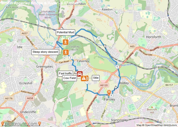
Distance: 6.1 Miles
Time: 2 hours 45 minutes
Elevation: 495 Feet
Terrain: Mixed
Start Point: Stanningley
End Point: Stanningley
Daily walks 10th-16th of May 2021 to support Mental Health Awareness Week #ConnectWithNature. https://runningseeds.co.uk/ | @RunningSeeds
OS Maps Required
OS Explorer Map (102, 103, 104, 105, 106, 107, 109 and 111) Cornwall Set
Map of Trail