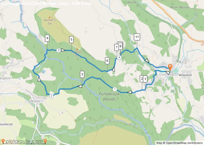
Distance: 5.0 Miles
Time: 2 hours 43 minutes
Elevation: 1965 Feet
Terrain: Off-Road
Start Point: Manaton
End Point: Manaton
Walk mainly in woods centered around river Bovey valley
OS Maps Required
OS Explorer Map (102, 103, 104, 105, 106, 107, 109 and 111) Cornwall Set
Map of Trail