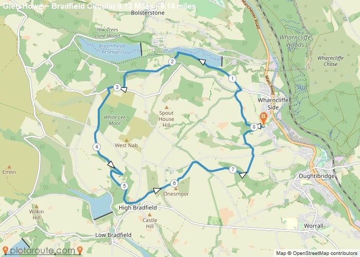
Distance: 8.1 Miles
Time: 4 hours 20 minutes
Elevation: 302 Feet
Terrain: Off-Road
Start Point: Wharncliffe Side
End Point: Wharncliffe Side
This is quite a strenuous walk and can be muddy after wet weather. It is an ‘up & over & back again’ type of walk and is a splendid route with excellent views on a good day.It leaves the start uphill, passing More Hall Reservoir, Walker Edge & White Lee Moor to drop down to views above Agden Reservoir & into High Bradfield. On the return it climbs to the highest point at Onesmoor before a long downhill back to the start.
OS Maps Required
OS Explorer Map (102, 103, 104, 105, 106, 107, 109 and 111) Cornwall Set
Map of Trail

