Distance: 2.5 Miles
Time: 1 hour 04 minutes
Elevation: 1486 Feet
Terrain: Mixed
Start Point: Gillingham
End Point: Gillingham
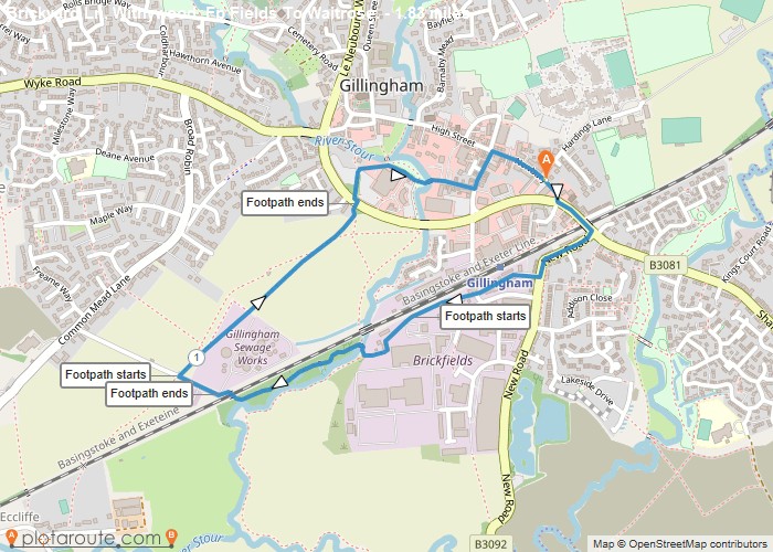
Fairey Crescent footpath may be muddy in inclement weather.
OS Maps Required
OS Explorer Map (102, 103, 104, 105, 106, 107, 109 and 111) Cornwall Set
Map of Trail