Distance: 5.3 Miles
Time: 2 hours 38 minutes
Elevation: 561 Feet
Terrain: Mixed
Start Point: Princetown
End Point: Princetown
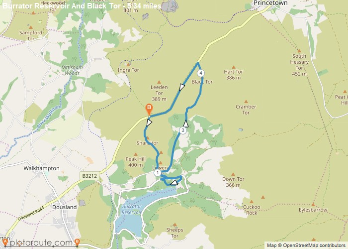
Looking south from the car park (50.519788, -4.032267) on the B3212, you can see Sharpitor. Climb the 500m to the top, a relatively easy climb. Enjoy the extensive views over Burrator Reservoir, with hills descending to Plymouth beyond.Look below you and see Leather Tor and beyond it, the woods surrounding Burrator Reservoir. Head for Leather Tor and climb up. Leather Tor is slightly more difficult than Sharpitor and requires more care.On the way down, bear slightly right and carefully descend from the tor until you reach Cross Gate.Go through, and follow the path, heading left, until it joins the road that runs around the reservoir. Access the waterfront from any one of the many easy points. There’s plenty of peaceful and picturesque picnic spots here.When you have finished exploring the reservoir, retrace your steps back to Cross Gate. Turn right to follow the Devonport Leat (open watercourse) up through the woods.The path leads up and out of the woods to some abandoned settlements. You can see Black Tor directly ahead. Climb this tor, passing the aqueduct on your right and the remains of the blowing house on the left. From Black Tor, head over the road and turn left. Follow the road for about 1.5 miles, and you will once again be at the car park.
OS Maps Required
OS Explorer Map (102, 103, 104, 105, 106, 107, 109 and 111) Cornwall Set
Map of Trail