Distance: 8.3 Miles
Time: 3 hours 57 minutes
Elevation: 2467 Feet
Terrain: Off-Road
Start Point: Littleborough
End Point: Littleborough
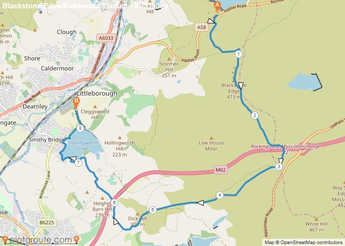
This route starts at The White House A58, along the Pennine Way, the Roman Road to Aiggin Stone. It continues on the Pennine Way over M62, turning past the Mast, following the trail parallel with M62. It descends & turns under the Rakewood Viaduct & to Hollingworth Caravan Park. From there it joins the track around the lake & back to Rakewood Road, where we left the 2nd car. It’s a bit of a cheat, because it cuts out the uphill section from the lake to the Pennine Way.
OS Maps Required
OS Explorer Map (102, 103, 104, 105, 106, 107, 109 and 111) Cornwall Set
Map of Trail