Distance: 4.4 Miles
Time: 1 hour 54 minutes
Elevation: 899 Feet
Terrain: Mixed
Start Point: Mirfield
End Point: Mirfield
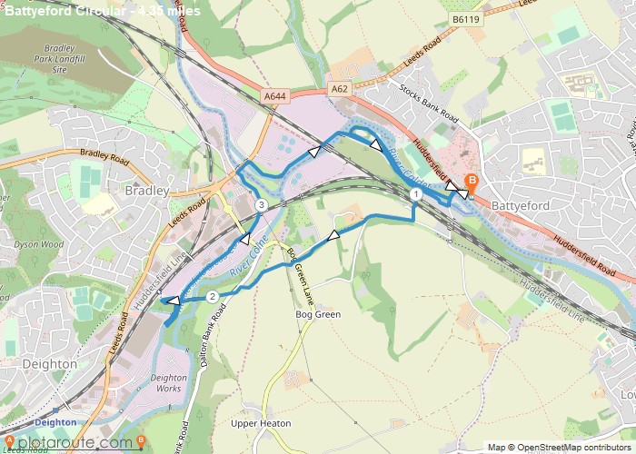
Starting from the Pear Tree Inn, this is a gentle stroll around Battyeford and Colnebridge. After crossing the River Calder, turn right onto the island and follow the track to the bridge and cross the canal, turn left and follow the towpath that takes you back towards Battyeford.After about 400 yards, turn right through a gap in the wall and go under the railway and up to Helme Lane. Turn right and follow the greenway until you cross the old railway viaduct at Bradley, follow the loop around back to the Ramsden canal at Bridge 5. Cross the bridge and turn left and follow the towpath to Leeds Road. Turn right and right again back onto the riverbank. Follow the track round the back of the treatment work and then cross the bridge over the river, this takes you back to the bridge you crossed earlier. Keep to the canal towpath until you reach the road at Wood Lane, turn left and return to the pub car park.
OS Maps Required
OS Explorer Map (102, 103, 104, 105, 106, 107, 109 and 111) Cornwall Set
Map of Trail