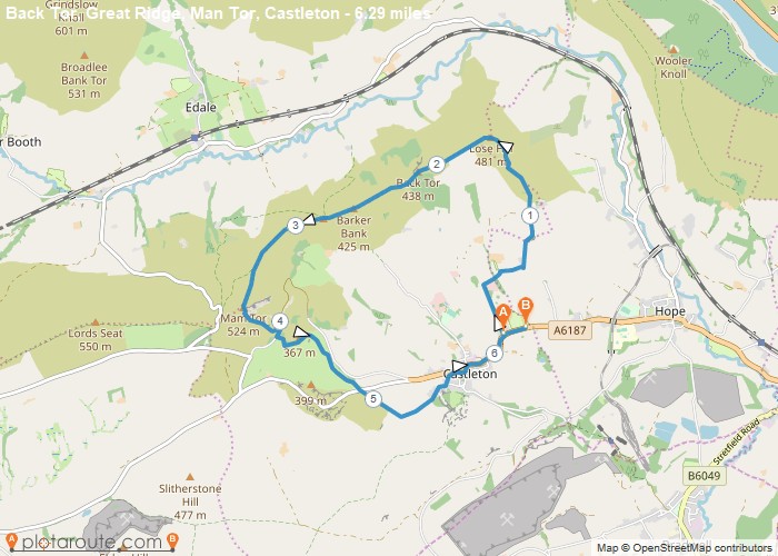
Distance: 6.3 Miles
Time: 3 hours 33 minutes
Elevation: 95 Feet
Terrain: Mixed
Start Point: Castleton
End Point: Castleton
A hilly A to B walking route, mostly off-road, approximately 6.3 miles long.
OS Maps Required
OS Explorer Map (102, 103, 104, 105, 106, 107, 109 and 111) Cornwall Set
Map of Trail