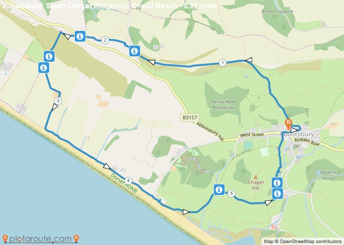
Distance: 6.0 Miles
Time: 2 hours 53 minutes
Elevation: 2119 Feet
Terrain: Mixed
Start Point: Abbotsbury
End Point: Abbotsbury
Abbotsbury, South Dorset Ridgeway, Chesil Beach.East Bexington, South West Coast Path, Wears Hill, St Catherine’s Chapel, Abbotsbury Swannery, Macmillan Way
OS Maps Required
OS Explorer Map (102, 103, 104, 105, 106, 107, 109 and 111) Cornwall Set
Map of Trail