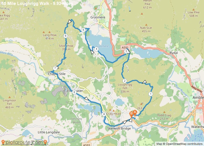
Distance: 9.9 Miles
Time: 5 hours 27 minutes
Elevation: 115 Feet
Terrain: Mixed
Start Point: Plantation Bridge
End Point: Plantation Bridge
Starting at house and going via Wainwrights and Chesters
OS Maps Required
OS Explorer Map (102, 103, 104, 105, 106, 107, 109 and 111) Cornwall Set
Map of Trail